Close this alert
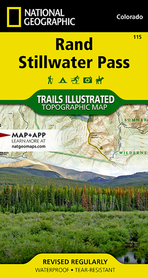
Rand, Stillwater Pass Map (National Geographic Trails Illustrated Map #115)
Current price:
$14.95
Publication Date: January 1st, 2019
Publisher:
National Geographic Maps
ISBN:
9781566952828
Pages:
2
Off the Beaten Path Bookstore
2 on hand, as of Apr 29 6:53am
(Maps/Atlases)
On Our Shelves Now
Description
- Waterproof - Tear-Resistant - Topographic Map
National Geographic's Trails Illustrated map of Rand and Stillwater Pass was designed for outdoor enthusiasts exploring this pristine mountainous area just outside of Rocky Mountain National Park. Expertly researched and created in cooperation with the U.S. Forest Service, Bureau of Land Management and others, the map provides unmatched detail of many popular recreational points of interest in and around Routt and Arapaho National Forests. Coverage includes Never Summer Wilderness, Seymour and Arapaho Lakes, Rabbit Ears Range, Bowen Gulch Protection Area and Arapaho Ridge as well as part of the Continental Divide.
Follow mapped trails, Forest Service roads and BLM routes as you adventure into this region of few amenities. Trails are marked according to their designated usage, whether hiking, biking, ATVing, snowmobiling or cross-country skiing, including a section of the Continental Divide Trail. To aid in your navigation, the map includes contour lines, elevations, labeled peaks and summits, water features, areas of wooded cover, selected waypoints and clear color-coded for national forests, wilderness areas and state parks. Other recreation features pinpointed area campgrounds, picnic areas, trailheads, wildlife viewing areas and fishing holes. Also listed are Leave No Trace Guidelines, wilderness regulations, safety tips and essential contact information.
Every Trails Illustrated map is printed on "Backcountry Tough" waterproof, tear-resistant paper. A full UTM grid is printed on the map to aid with GPS navigation.
Other features found on this map include: Arapaho National Forest, Never Summer Wilderness, Owl Mountain, Parkview Mountain, Rabbit Ears Range, Routt National Forest.
Map Scale = 1:40,680Sheet Size = 25.5" x 32"Folded Size = 4" x 7.5"
Other Books in Series
Glacier and Waterton Lakes National Parks Map (National Geographic Trails Illustrated Map #215)
Folded
Death Valley National Park Map (National Geographic Trails Illustrated Map #221)
Folded
Zion National Park Map (National Geographic Trails Illustrated Map #214)
Folded
Camino de Santiago West Map [Map Pack Bunde] Map (National Geographic Trails Illustrated Map)
Folded
Grand Teton National Park Map (National Geographic Trails Illustrated Map #202)
Folded
Yellowstone National Park Map (National Geographic Trails Illustrated Map #201)
Folded
Grand Canyon, North and South Rims Map [Grand Canyon National Park] (National Geographic Trails Illustrated Map #261)
Other
Yosemite National Park Map (National Geographic Trails Illustrated Map #206)
Folded
Olympic National Park Map (National Geographic Trails Illustrated Map #216)
Folded
Great Smoky Mountains National Park Map (National Geographic Trails Illustrated Map #229)
Folded
Mount Rainier National Park Map (National Geographic Trails Illustrated Map #217)
Folded
Baxter State Park Map [Mount Katahdin, Katahdin Iron Works] (National Geographic Trails Illustrated Map #754)
Folded
North Cascades National Park Map (National Geographic Trails Illustrated Map #223)
Folded
Lake Placid, High Peaks: Adirondack Park Map (National Geographic Trails Illustrated Map #742)
Folded
Acadia National Park Map (National Geographic Trails Illustrated Map #212)
Folded
Rocky Mountain National Park Map (National Geographic Trails Illustrated Map #200)
Folded
Isle Royale National Park Map (National Geographic Trails Illustrated Map #240)
Folded
Northville, Raquette Lake: Adirondack Park Map (National Geographic Trails Illustrated Map #744)
Folded
Big Bend National Park Map (National Geographic Trails Illustrated Map #225)
Folded
Bryce Canyon National Park Map (National Geographic Trails Illustrated Map #219)
Folded