Close this alert
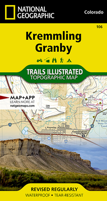
Kremmling, Granby Map (National Geographic Trails Illustrated Map #106)
Current price:
$14.95
Publication Date: March 7th, 2023
Publisher:
National Geographic Maps
ISBN:
9781566953368
Pages:
2
Off the Beaten Path Bookstore
1 on hand, as of Apr 26 6:07am
(Maps/Atlases)
On Our Shelves Now
Description
- Waterproof - Tear-Resistant - Topographic Map
National Geographic's Trails Illustrated map of Kremmling and Granby delivers unmatched detail and valuable information to assist you in your exploration of this popular recreational area. Expertly researched and created in partnership with local land management agencies, this map features key points of interest including Arapaho National Recreation Area; Wolford Mountain, Hinman, Willow Creek, and Williams Fork reservoirs; Cottonwood and Gunsight passes; Hot Sulphur Springs, Junction Butte, and Kemp-Breeze state wildlife areas; portions of the Colorado and Blue rivers; and the towns of Kremmling, Granby, Parshall, and Hot Sulphur Springs. Additional information on the Wolford Mountain Area which has an extensive system of routes for travel by foot, horse, mountain bike, motorcycle, ATV, and 4x4 is also included.
This map can guide you off the beaten path and back again with miles of clearly defined trails including portions of the Colorado and Continental Divide trails. Hard surface and mountain bike trails are differentiated. The Colorado River Headwaters Scenic Byway is noted for those wishing to take in the scenery by car. Recreation features are clearly marked, including campgrounds, trailheads, wildlife viewing areas, fishing access, boat launches, and whitewater access. The map base includes contour lines and elevations for summits, passes and many lakes.
Every Trails Illustrated map is printed on "Backcountry Tough" waterproof, tear-resistant paper. A full UTM grid is printed on the map to aid with GPS navigation.
Other features found on this map include: Arapaho National Forest.
Map Scale = 1:40,680Sheet Size = 25.5" x 32"Folded Size = 4" x 7.5"
Other Books in Series
Zion National Park Map (National Geographic Trails Illustrated Map #214)
Folded
Camino de Santiago West Map [Map Pack Bunde] Map (National Geographic Trails Illustrated Map)
Folded
Yosemite National Park Map (National Geographic Trails Illustrated Map #206)
Folded
Olympic National Park Map (National Geographic Trails Illustrated Map #216)
Folded
Glacier and Waterton Lakes National Parks Map (National Geographic Trails Illustrated Map #215)
Folded
Death Valley National Park Map (National Geographic Trails Illustrated Map #221)
Folded
Acadia National Park Map (National Geographic Trails Illustrated Map #212)
Folded
Yellowstone National Park Map (National Geographic Trails Illustrated Map #201)
Folded
Grand Canyon, North and South Rims Map [Grand Canyon National Park] (National Geographic Trails Illustrated Map #261)
Other
Grand Teton National Park Map (National Geographic Trails Illustrated Map #202)
Folded
Baxter State Park Map [Mount Katahdin, Katahdin Iron Works] (National Geographic Trails Illustrated Map #754)
Folded
Lake Placid, High Peaks: Adirondack Park Map (National Geographic Trails Illustrated Map #742)
Folded
North Cascades National Park Map (National Geographic Trails Illustrated Map #223)
Folded
Rocky Mountain National Park Map (National Geographic Trails Illustrated Map #200)
Folded
Northville, Raquette Lake: Adirondack Park Map (National Geographic Trails Illustrated Map #744)
Folded
Big Sur, Ventana Wilderness Map [Los Padres National Forest] (National Geographic Trails Illustrated Map #814)
Other
Bryce Canyon National Park Map (National Geographic Trails Illustrated Map #219)
Folded
Denali National Park and Preserve Map (National Geographic Trails Illustrated Map #222)
Folded
Yellowstone and Grand Teton National Parks [Map Pack Bundle] (National Geographic Trails Illustrated Map)
Folded
Grand Teton Day Hikes and National Park Map [Map Pack Bundle] (National Geographic Trails Illustrated Map)
Folded