Close this alert
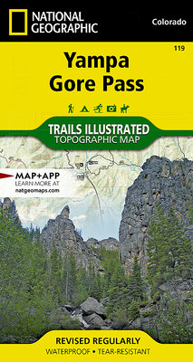
Yampa, Gore Pass Map (National Geographic Trails Illustrated Map #119)
Current price:
$14.95
Publication Date: January 1st, 2006
Publisher:
National Geographic Maps
ISBN:
9781566953931
Pages:
2
Off the Beaten Path Bookstore
1 on hand, as of Apr 22 4:08am
(Maps/Atlases)
On Our Shelves Now
Description
- Waterproof - Tear-Resistant - Topographic Map
Outdoor enthusiasts seeking to enjoy the year-round recreational opportunities in and around southern Routt National Forest will marvel at National Geographic's Trails Illustrated map of Yampa and Gore Pass. Created in cooperation with the U.S. Forest Service, Bureau of Land Management and others, this expertly researched map delivers unparalleled detail of the area. Coverage includes Arapaho National Forest, Sarvis Creek Wilderness, Five Pine Mesa, Egeria Park, King Mountain, Gore Range and Red Dirt Reservoir.
Let mapped trails guide you off the beaten path and back on again. Trails and Forest Service roads are marked for hiking, cross-country ski, snowmobiles or other motorized use. To aid in your navigation, the map also includes contour lines, elevations, labeled peaks, summits and passes, water features, areas of wooded cover, selected waypoints and clear color-coded boundaries between different land management agencies. Some of the other recreation features pinpointed are areas for camping, picnicking, climbing, skiing and wildlife viewing. Additionally, wilderness regulations, survival tips, Leave No Trace guidelines and essential contact information is provided.
Every Trails Illustrated map is printed on "Backcountry Tough" waterproof, tear-resistant paper. A full UTM grid is printed on the map to aid with GPS navigation.
Other features found on this map include: Arapaho National Forest, Gore Mountain, Routt National Forest, Sarvis Creek Wilderness.
Map Scale = 1:40,680Sheet Size = 22" x 32"Folded Size = 4" x 7.5"
Other Books in Series
Zion National Park Map (National Geographic Trails Illustrated Map #214)
Folded
Yellowstone National Park Map (National Geographic Trails Illustrated Map #201)
Folded
Camino de Santiago West Map [Map Pack Bunde] Map (National Geographic Trails Illustrated Map)
Folded
Yosemite National Park Map (National Geographic Trails Illustrated Map #206)
Folded
Olympic National Park Map (National Geographic Trails Illustrated Map #216)
Folded
Glacier and Waterton Lakes National Parks Map (National Geographic Trails Illustrated Map #215)
Folded
Death Valley National Park Map (National Geographic Trails Illustrated Map #221)
Folded
Acadia National Park Map (National Geographic Trails Illustrated Map #212)
Folded
Grand Canyon, North and South Rims Map [Grand Canyon National Park] (National Geographic Trails Illustrated Map #261)
Other
Grand Teton National Park Map (National Geographic Trails Illustrated Map #202)
Folded
Baxter State Park Map [Mount Katahdin, Katahdin Iron Works] (National Geographic Trails Illustrated Map #754)
Folded
Mount Rainier National Park Map (National Geographic Trails Illustrated Map #217)
Folded
Lake Placid, High Peaks: Adirondack Park Map (National Geographic Trails Illustrated Map #742)
Folded
Canyonlands National Park Map (National Geographic Trails Illustrated Map #210)
Folded
Rocky Mountain National Park Map (National Geographic Trails Illustrated Map #200)
Folded
Northville, Raquette Lake: Adirondack Park Map (National Geographic Trails Illustrated Map #744)
Folded
Big Sur, Ventana Wilderness Map [Los Padres National Forest] (National Geographic Trails Illustrated Map #814)
Other
Bryce Canyon National Park Map (National Geographic Trails Illustrated Map #219)
Folded
Denali National Park and Preserve Map (National Geographic Trails Illustrated Map #222)
Folded
Clinch Ranger District Map [Jefferson National Forest] (National Geographic Trails Illustrated Map #793)
Folded